University of Melbourne Flight Path
University of Melbourne
Orbit Solutions delivers advanced 3D spatial modelling and impact analysis to help the University of Melbourne navigate the structural constraints of a newly proposed hospital helicopter flight path.
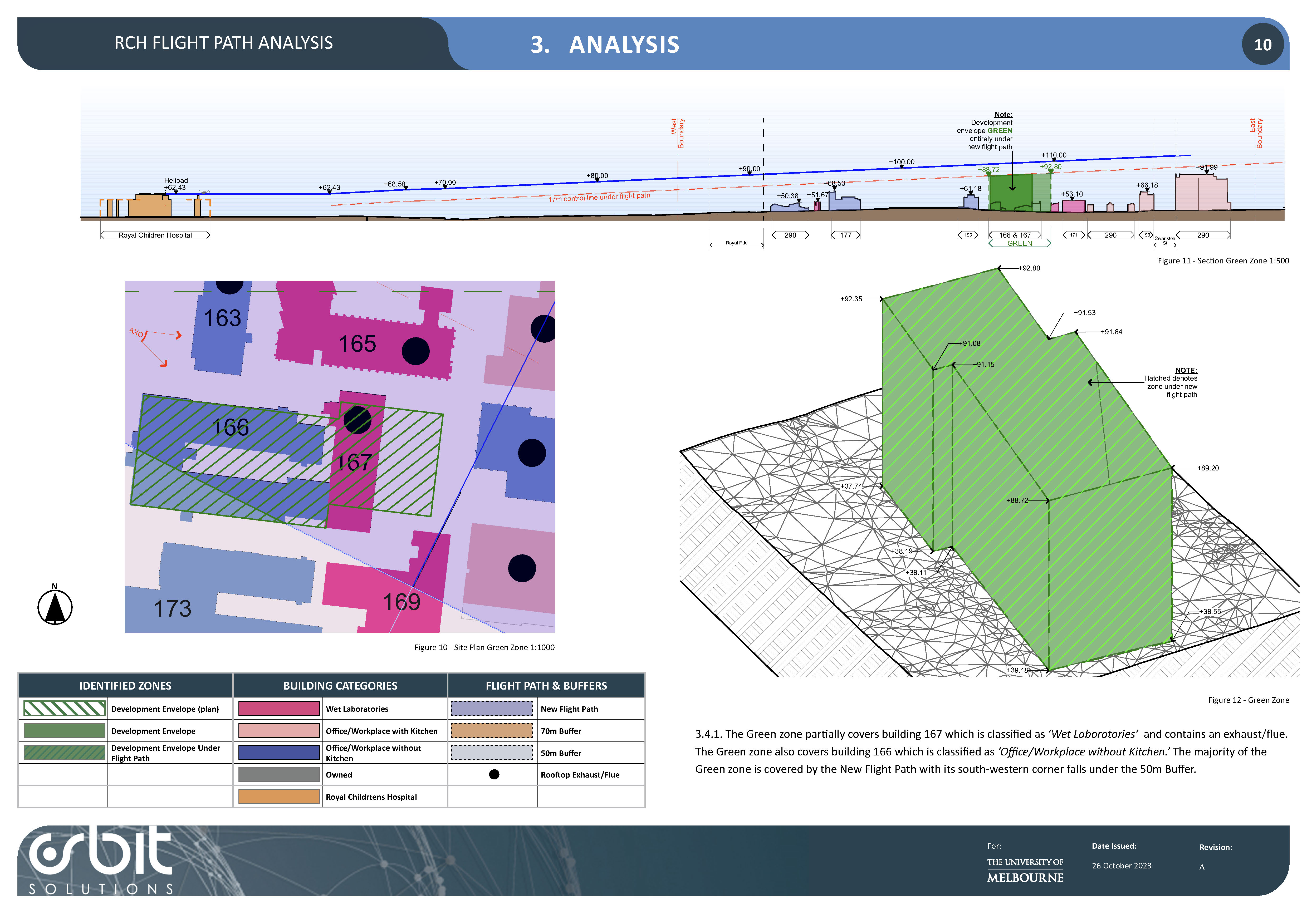
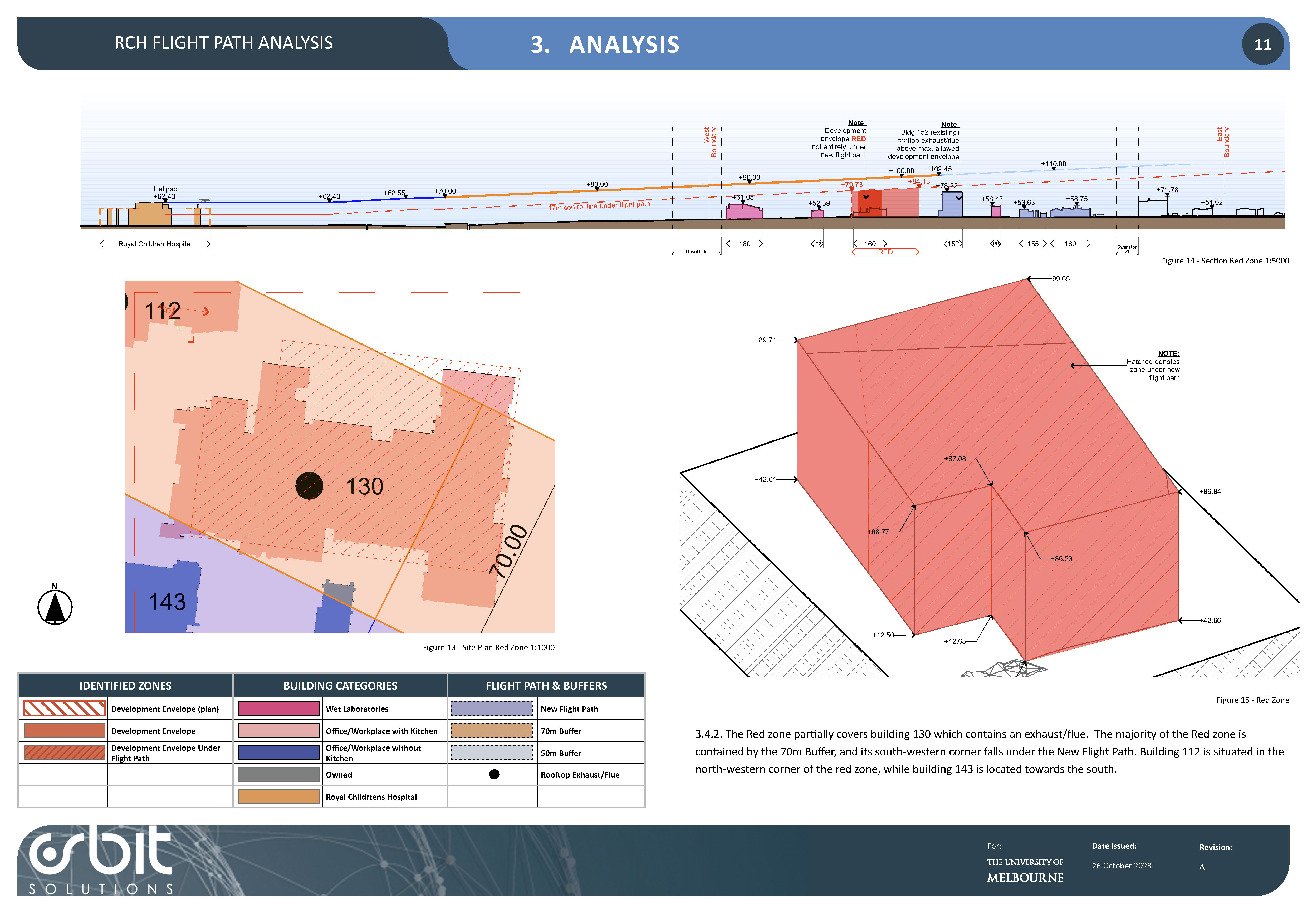
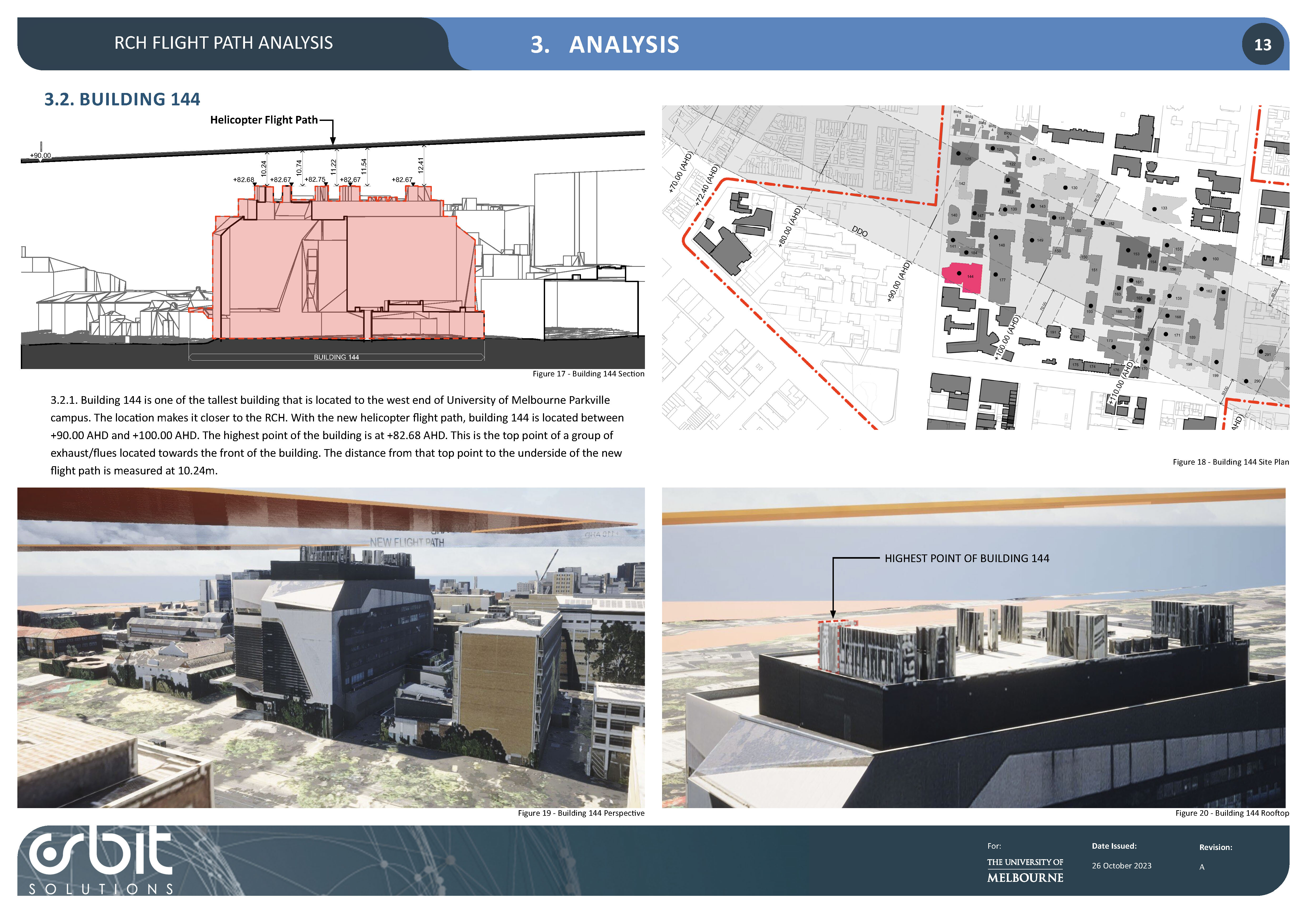
When proposed developments in the nearby medical precinct required the Royal Children’s Hospital (RCH) helicopter flight path to be realigned directly over the University of Melbourne’s Parkville campus, the University commissioned Orbit Solutions to assess the resulting spatial constraints. Drawing upon over two decades of architectural and visual amenity expertise, Orbit produced a comprehensive Safety and Visual Impact Analysis report that evaluated the mutual impacts between the University's infrastructure and the new aviation route.
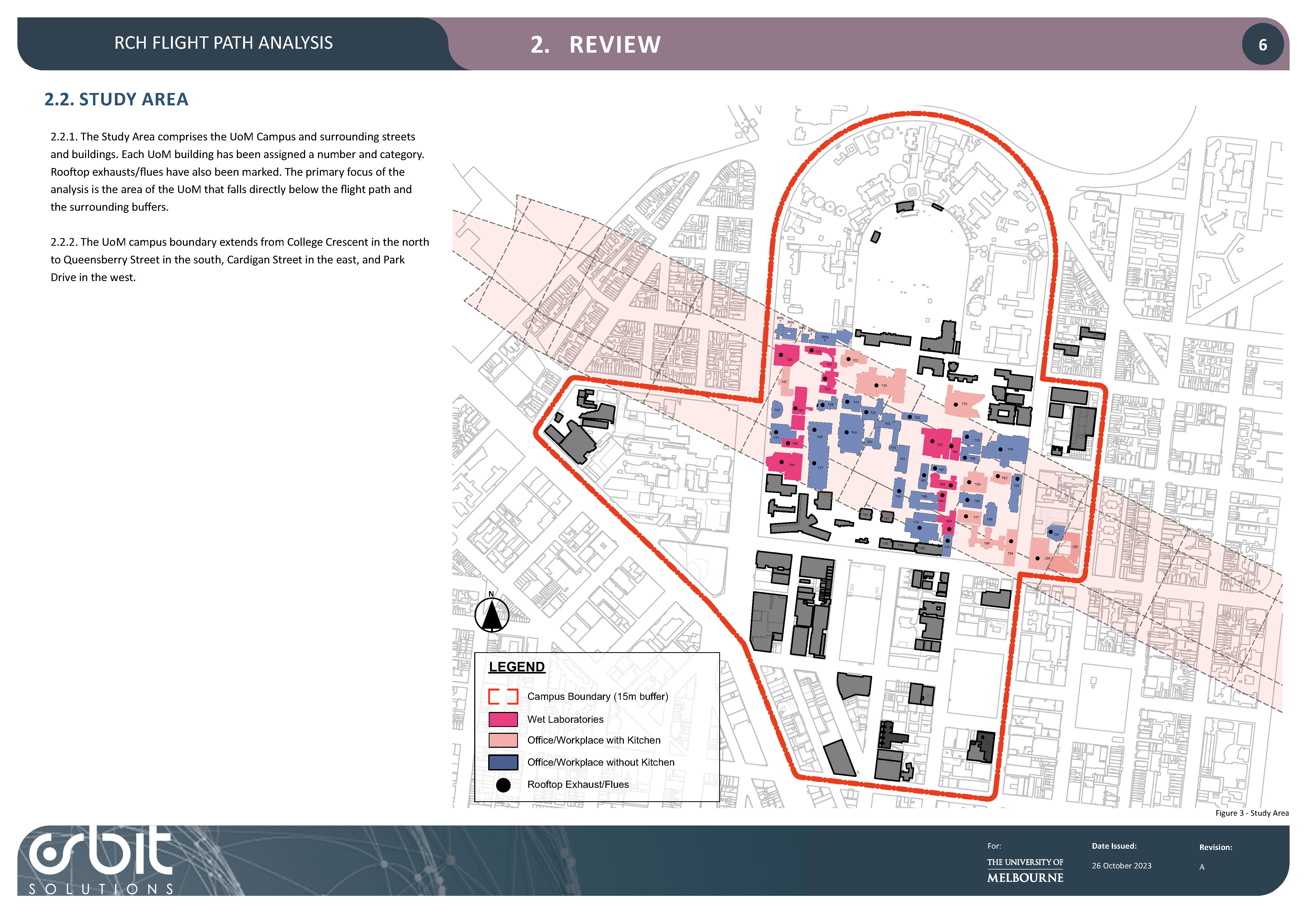
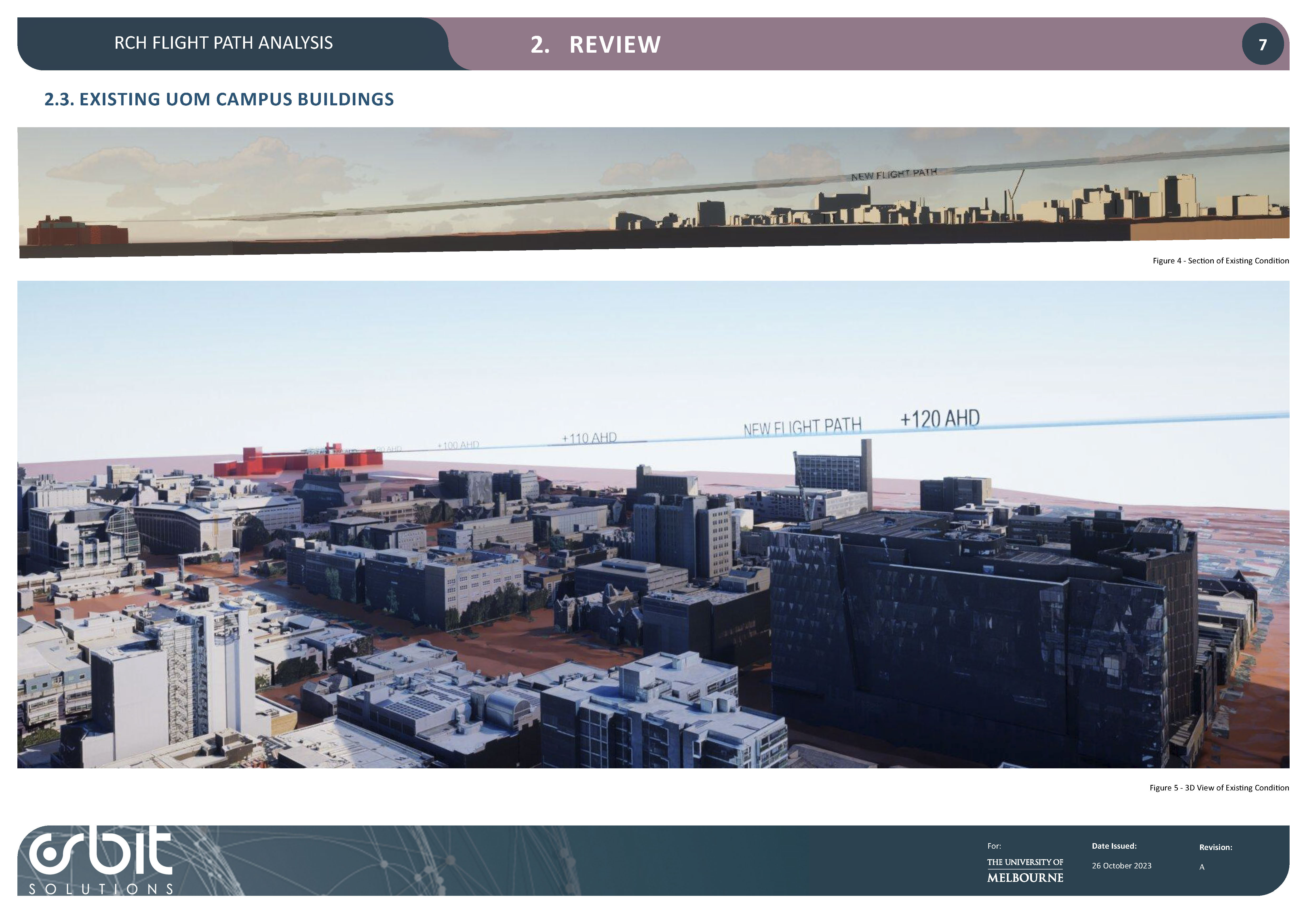
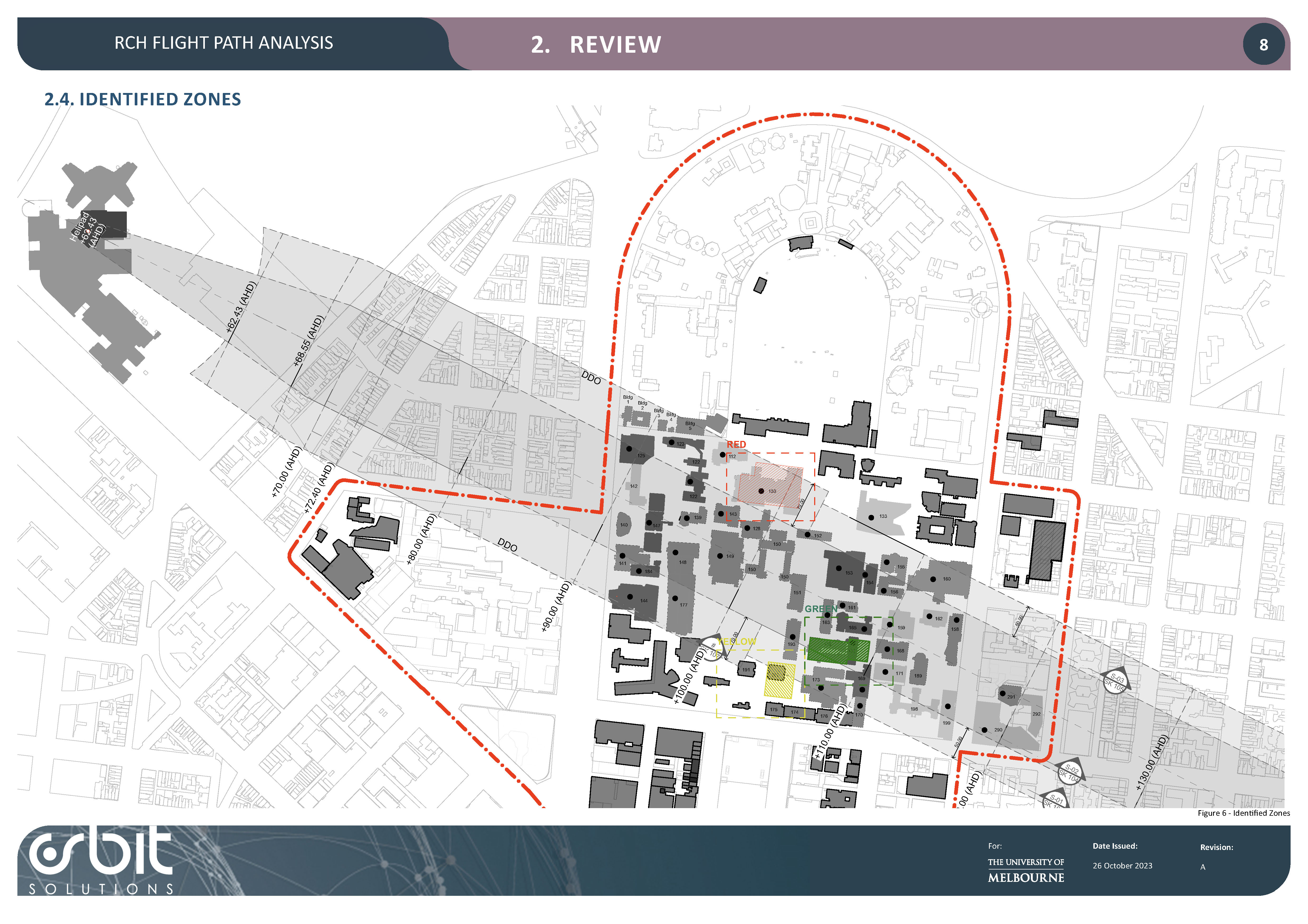
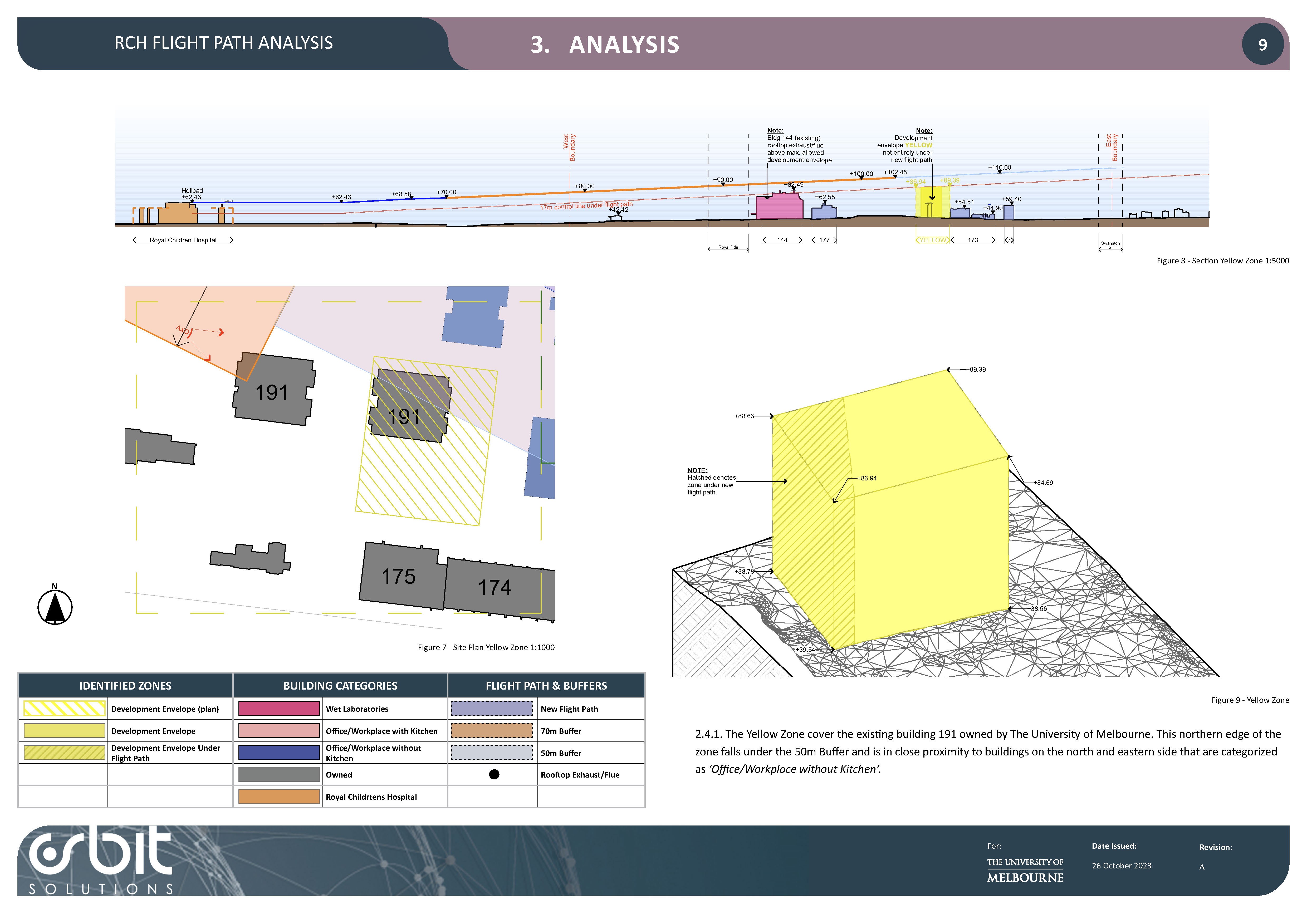
Orbit’s central role involved utilizing high-resolution 3D city and digital elevation models to precisely map the proposed flight path over the campus study area. By analyzing this spatial data, Orbit successfully defined the maximum built form envelope for key future development sites and identified operational constraints for current and future rooftop mechanical plants situated beneath the new flight corridor.