Lysterfield Lake College
Environmental/Energy Consultant: Equis Australia Management
Lawyer: HWL Ebsworth Lawyers
Client: Pared Victoria Limited
Architect: Cullen Architects
Town Planning: Hansen Partnership Pty Ltd
Landscape Architect: Hansen Partnership Pty Ltd
Lawyer: HWL Ebsworth Lawyers
Traffic Engineer: Traffix Group Pty Ltd
A comprehensive Visual Impact Assessment to resolve VCAT's design concerns and secure planning approval for a school within a protected Green Wedge landscape.
Orbit Solutions was engaged by the Applicant's lawyer in February 2024 to prepare a comprehensive Visual Impact Assessment (VIA) for the proposed Lysterfield Lake College at 19-23 Horswood Rd, Narre Warren North. The brief followed a Request for Further Information from the Responsible Authority and built on earlier preliminary advice provided in 2023 to guide the school's design revisions. Orbit Solutions' task was to test the redesigned proposal against Green Wedge A Zone and Significant Landscape Overlay requirements, and to directly address the concerns raised in VCAT's 2022 decision that had found the original, larger school design unacceptable.
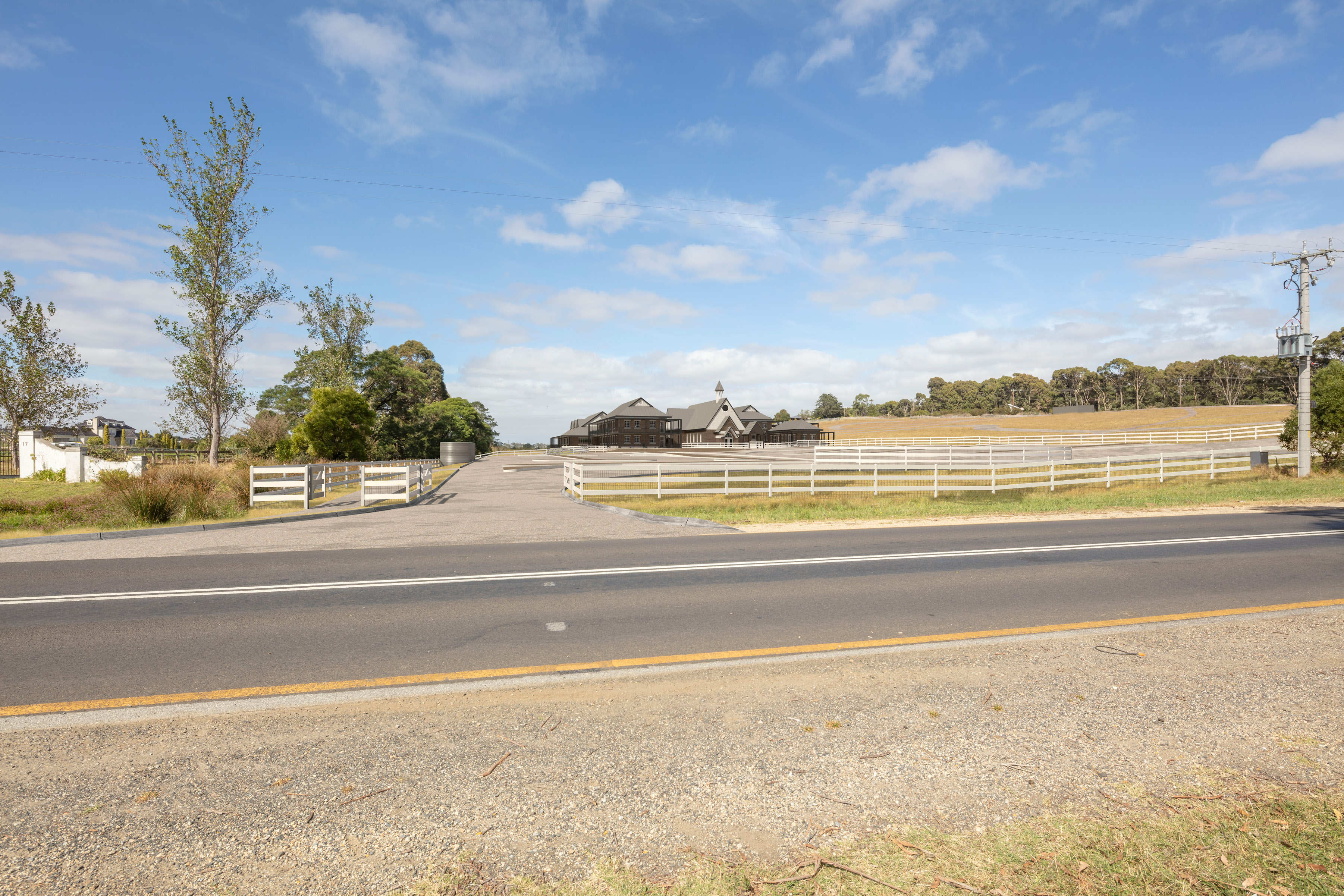
To carry out the assessment, Orbit Solutions applied a structured methodology combining internationally recognised visual impact practice with site-specific analysis. This included using AlignView photomontages from key observation points to measure contrast in landform, vegetation and built structure, and establishing the site's Visual Absorption Class to determine how much change the landscape could reasonably accommodate. The site's Visual Sensitivity was rated Moderate (3.0), with a Visual Absorption Class of III providing a Moderate Visual Absorption Capacity.
Orbit Solutions found that the redesigned school, evaluated with and without proposed landscaping, produced a Magnitude of Change (2.8 and 2.4 respectively) that fell within the site's absorption capacity, meaning the proposal satisfied visual compatibility requirements. The assessment confirmed that the revised design resolved the scale, siting and earthworks issues previously identified by the Tribunal, and Orbit Solutions issued two targeted recommendations, a minor northward shift of the Chapel and relocation of two sports field sheds, to further reduce visual impact from Horswood Road.
The completed VIA demonstrated that the revised proposal complied with the relevant provisions of the Casey Planning Scheme and provided the Applicant with the technical evidence needed to support the school's design through the planning process, directly responding to and resolving the issues raised in the prior VCAT decision.
GIS MAPPING
KEY OBSERVATION POINT 1
Cnr Horswood Road & Logan Park Road, on roundabout situated immediately before parking areas and main entrance to Lysterfield Park, on roundabout nature area.
KEY OBSERVATION POINT 2
Road Shoulder / Stopping lane in Horswood Road, Northern shoulder, approximately opposite entrance to 17 Horswood Road.
KEY OBSERVATION POINT 3
Eastern Road shoulder, on nature reserve, opposite crossover entrance to 365 - 367 Belgrave Hallam Road.